

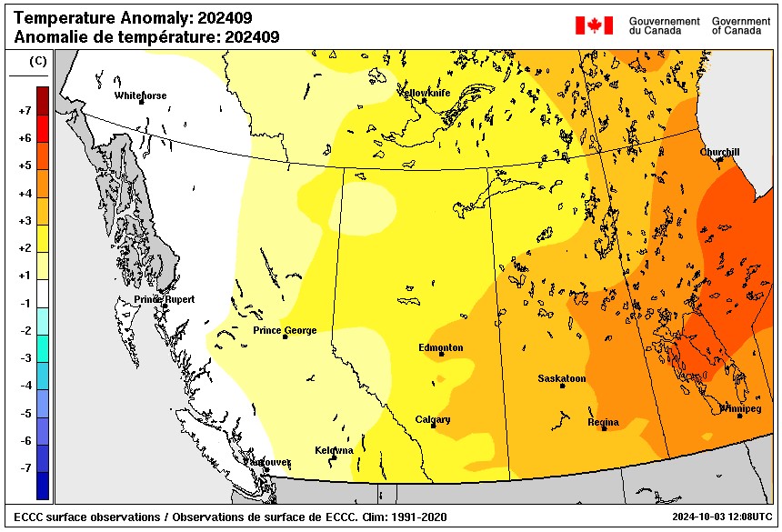
September was warmer than normal and not a lot of rain fell except in the west-central and southwest areas of Saskatchewan.
The monthly weather stats from Environment Canada show much of September was above average for temperatures. Danielle Desjardins, a Meteorologist at the national weather office, says all weather stations were in the top 5 for warmest month on record.
“A persistent ridge of high pressure which caused the jet stream to bring in a lot of warm, dry air from the south, so we were under the influence of this upper ridge for most of the month – give or take a couple days of the month – but that’s what was really driving most of the weather for the month of September, and that’s why we were seeing a flood of warm air over much of southern and central Saskatchewan.” said Desjardins.
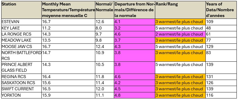
Regina was one of those areas that recorded its third warmest month with an average temperature of 16.4 degrees; the typical average for the Queen City is 11.8 degrees. Saskatoon, Swift Current, Yorkton, North Battleford, Meadow Lake, and Estevan also recorded their third warmest September. Key Lake, Moose Jaw, and Prince Albert recorded their fifth warmest month.
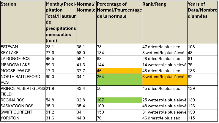
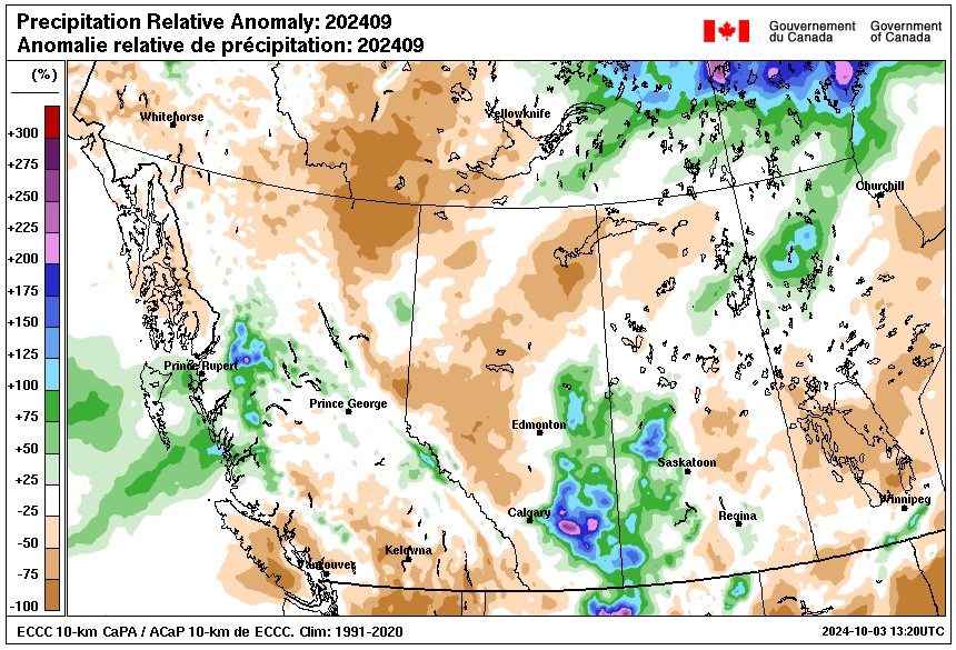
Desjardins noted the east and southeast areas were drier than normal last month but a thunderstorm between September 17th and 18th brought various amounts of precipitation across the province. North Battleford and Regina got a lot of rain from separate storms.
“Those thunderstorms can produce a lot of precipitation in a short period of time so that can really skew some of the measurements if it hits the (weather) station directly,” she said.
North Battleford had 90 mm and Regina 54.8 mm, both well above their yearly averages. Key Lake, Meadow Lake, and Swift Current also had more rain than normal last month.
September saw a lot of lightning activity – 125% of average which is the sixth highest for the month in about 22 years of record, noted Desjardins.
“It was a fairly active year for lightning and thunderstorms especially this late in the season. Some of that is due to the fact that we did have the warmer temperatures so that gives it a little bit more energy for these thunderstorm systems to develop.”